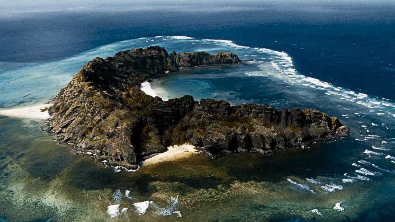
Top 10 strangest uninhabited islands – you’ve never heard of human presence. Exploring the world’s uninhabited islands reveals a realm of mystery, isolation, and sometimes terrifying beauty. These islands, untouched by human presence, harbor the secrets of nature’s wonders and geological wonders. From remote spots in the vast oceans to forgotten atolls, each uninhabited island has its unique allure, often capturing the imaginations of adventurers and scientists alike.
In this compilation, we embark on a journey to discover fifteen of the strangest and most mysterious uninhabited islands scattered around the world. Get ready to venture into realms where nature reigns, where the echoes of human footsteps are absent, and where stories of these forgotten lands whisper through the winds and waves.
Table of Contents
Here Are The 10 Strangest Uninhabited Islands
10: Jaco Island East Timor

Jaco Island is an uninhabited island in East Timor made of limestone formed from Coral Limestone Cliffs, and coral reefs that surround this densely forested island which is part of the Ninoon Santana National Park. Although the people of East Timor will accommodate tourists on the island for day trips or even camping trips, it has no permanent inhabitants due to it being regarded as sacred. This is because the beach and the channel are sometimes said to be the points where.
The Timor Sea or the Men’s Sea meets the boundary between the Banda Sea or the Women’s Sea, including Wetar Strait to the north and Tamori to the south. The island supports populations of bar-neck cuckoos, black cuckoo doves, pink-headed imperial pigeons, streak-breasted honeyeaters, fawn-breasted whistlers, blue-cheeked flowerpeckers, flame-breasted sunbirds, and of course, Tore sparrows.
Rare birds such as the great cuckoo dove and the awesomely named Orphus fathead live on the island. The Java russa are also found here, which have become accustomed to drinking salt water due to the island’s lack of fresh water. In 2019, about 80 deer were counted on the island, and the beaches in the southeast are used by sea turtles to lay their eggs.
At least three places on the island have the remains of ancient fortifications. Built by the local population to protect settlements – Lai Pet and Honati. The only modern structure on the island was a lighthouse from the Indonesian occupation period, a white scaffold tower about 35m high.
09: Koshima Island Japan
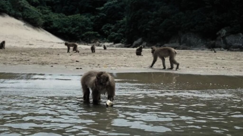
So you’ve heard of Planet of the Apes; well, how about the Island of the Rabbits? 3 km off the coast of Japan, this bizarre place is overrun with rabbits, which are not even native to this land. So how did they get there? Well, it’s a bit of a mystery. We do know that Okunishima Island was the site of a chemical weapons plant from 1929 to 1945, which produced poison gas for the Japanese Imperial Army.
One theory is that an Allied occupation force dismantled the plant, let the lab animals go free, and the bunnies quickly populated. However, another tale suggests that visiting schoolchildren released rabbits on the island in 1971. Either way, Okunoshima Island was open to tourism in the 1960s, and since then, viral videos of the furry inhabitants have caused several visitors to soar. That chemical weapons facility would go on to produce over 6 kilotons of mustard gas and tear gas.
Despite Japan being a signatory of the 1925 Geneva Protocol, which banned the use of chemical warfare, it didn’t, however, ban the development and storage of chemical weapons. But as for the current long-eared inhabitants, well, hunting rabbits is forbidden, and dogs and cats are not allowed on the island for a similar reason. So even if their ancestors were used in horrific experiments, these current-day island dwellers live a much more peaceful and happy life.
08: Moniki Fiji Islands
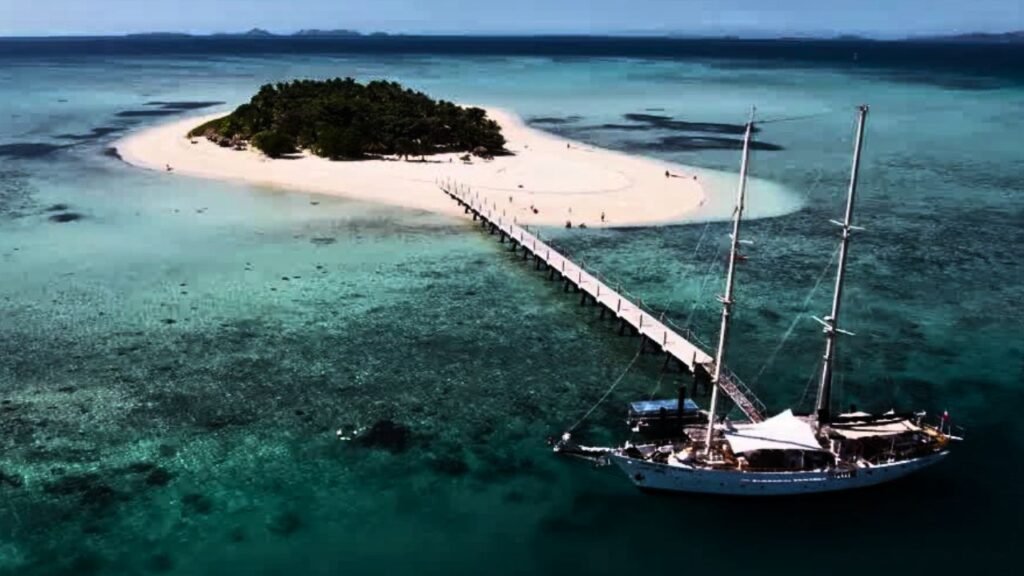
When it comes to uninhabited islands, they don’t come more iconic than the one from Tom Hanks’ movie Cast Away, and this next location is where every scene from that blockbuster was filmed. Moniki is a small uninhabited island situated off the coast of Viti Levu in the Fiji Islands in Melanesia in the South Pacific Ocean, with a terrain that includes volcanic rocks, lagoons, palm trees, a pine forest, and several small white sand beaches.
Following a mutiny on the HMS Bounty on April 28th, 1789, Captain William Bligh was the first Westerner to sight this group of 20 islands when Bligh’s open boat journey made the first passage by Europeans through the area, which is why the area north of Viti Levu, which encompasses Moniki, is named Bligh Water. However, the island remained largely ignored by the wider world until the United States used them as communication outposts during World War II.
Since Tom Hanks and the company decided to use it for filming their modern-day Robinson Crusoe story, Moniki has become known as Castaway Island. It’s now become a tourist attraction, but although visitors are allowed and indeed encouraged, it still has no permanent inhabitants.
Read More: Haunted Buildings In The World
07: Battleship Island Japan
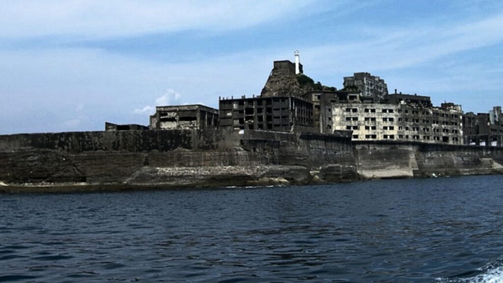
Hashima Island, one of 505 uninhabited islands in Nagasaki Prefecture, is often called Battleship Island because it looks like it. The most prominent features of the island are its abandoned concrete buildings, unobstructed nature, and surrounding sea walls. While the island is a symbol of Japan’s rapid industrialization, this Japanese war crime is also a reminder. Before that as a site of forced labor, and during World War II. The 16-acre island was known for it is underwater coal mines, and was established in 1887.
Who worked during the industrialization of Japan. The island reached a peak population of about 5,200 people in 1959. In 1974, with the coal reserves nearly exhausted, the mine was closed, and all the residents left. Soon after, interest in the island reemerged in the 2000s on account of its undisturbed historic ruins, and it gradually became a tourist attraction.
Travel to Hashima Island was reopened to tourists on April 22nd, 2009. Interest in the island is growing as a result of efforts to preserve it as an industrial heritage site. After much controversy, the island’s coal mine was approved as a UNESCO World Heritage Site in July 2015 as part of Japan’s Meiji Industrial Revolution series of sites.
06: Aldabra Island

Aldabra is one of the external islands of the Seychelles, the biggest island of the Seychelles, and is located near the coast of Africa. The 2nd biggest atoll in the world after Kiritimati. Due to some access difficulties and the isolation of the atoll, Aldabra has remained virtually untouched by humans and thus retains some of the 152,000 giant tortoises, the largest population of this animal in the world. Is.
They are one of the world’s longest-living animals, with an average lifespan of 100 years or more. The atoll is also known as a breeding ground for coconut crabs, the world’s largest land crab, hammerhead sharks, manta rays, barracudas, and green and hawksbill turtles. Initially named by Arab seafarers for the harsh environment, Aldabra became a French colony dependency in the 18th century, leading to the exploitation of its natural resources.
After passing through the hands of the British, in the 1960s, Aldabra faced potential military uses. But it was protected as a result of international protests. This atoll boasts unique geography featuring the world’s largest raised coral reef and a large shallow lagoon. Its history involves human impact, including failed agricultural ventures. Post-World War I conservation efforts increased, though, leading to its inclusion in the British Indian Ocean Territory and eventually independence for the Seychelles.
Following an international protest by scientists known as the Aldabra Affair, the Royal Society of London and later the Seychelles Island Foundation conducted research leading to Aldabra’s declaration as a UNESCO World Heritage Site in 1982. Conservation challenges such as invasive species and plastic pollution remain, but conservation measures, including UNESCO designation, highlight Aldabra’s importance as a natural, important scientific research site.
05: Fort Carroll Island United States
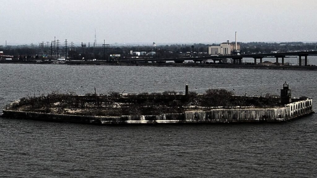
The US Army built Fort Carroll in 1847 to protect Baltimore Maryland in the middle of the Patapsco River. The site was chosen because experience had shown that a defensive fort built too close to the city caused more problems than it solved. This artificial island was made under the supervision of Robert E. Lee, who also designed the island’s hexagonal shape. But the fort was still incomplete by the time the Civil War began.
Construction was halted, and by the time the war ended, the lack of convenience became apparent. The fort was modernized but not in time to be much used during the Spanish-American War. The Army abandoned Fort Carroll for good in 1921. Various proposals were made for the use of the island, including a prison, and the 1923 plan was modified by Baltimore Mayor William Bruning. An electric welcome sign on the island was accompanied by a statue of Lord Baltimore.
In World War II, the Army briefly decided to use the fort again as a firing range, with it also serving as a checkpoint for vessels. But otherwise, by this point, they were pretty much done with it. In May 1958, Baltimore attorney Benjamin Eisenberg purchased the island for $10,000, intending to put a casino there.
But development plans never materialized. The fort is now deserted besides various animals, although it’s a hotspot for urban explorers. In 2013, Preservation Maryland placed Fort Carroll on its list of threatened historic properties, and in 2014, it was listed on the National Register of Historic Places.
04: Balls Pyramid Island
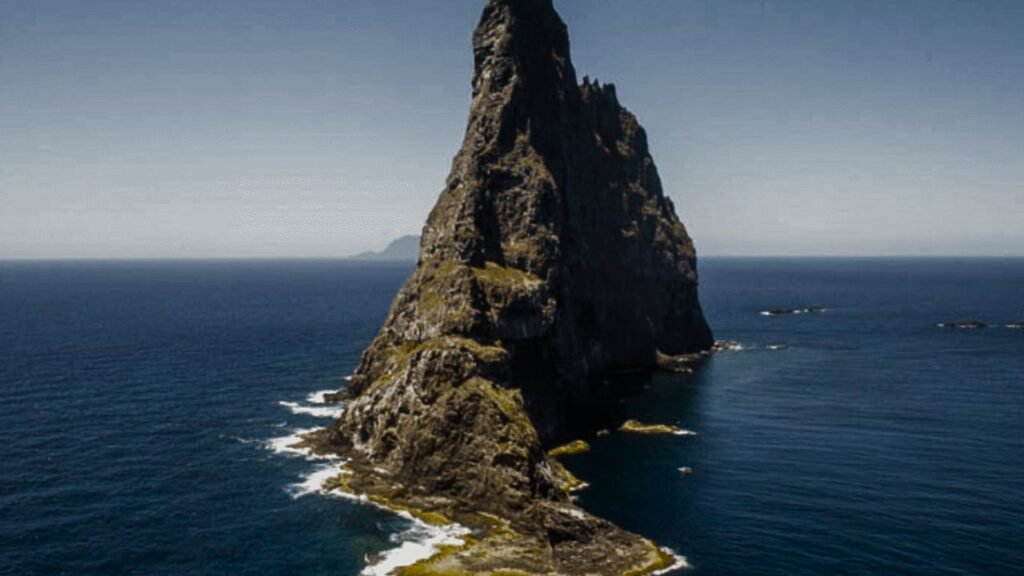
Balls Pyramid, other than having an awesome name, is the remnant of a volcano that formed about 7 million years ago. It’s a 562-meter-high rock island located 13 miles southeast of Lord Howe Island in the Pacific, part of Australia’s Lord Howe Island Marine Park. This uninhabited island is positioned right in the center of a submarine shelf surrounded by rough seas, which makes any approach difficult.
The pyramid is named after Lieutenant Henry Ball of the Royal Navy, In 1788 it was reported to have been discovered. Balls Pyramid’s nearest landmass, although the first recorded person to go ashore, is believed to have been Henry Wilkinson, a geologist at the New South Wales Department of Mines, in 1882. Ball’s Pyramid has a few satellite islands: Observatory Rock and Wheatsheaf Islet are located approximately 800 meters west-northwest and west-southwest of the western extremity of Ball’s Pyramid, respectively.
The shelf is 20 kilometers long and averages about 10 kilometers in width, and they lie under an average depth of about 50 meters. The cliffs of the stack continue underwater to the level of the shelf. The first successful ascent of the peak was in 1965 by a team of Australian climbers. A year before, another team of climbers rediscovered the Lord Howe Island stick insect, thought to be extinct. It is called the world’s rarest insect.
The rediscovered population consists of fewer than 30 individuals. Since 1982, as amended by the Lord Howe Island Act, climbing the Balls Pyramid has been banned. In 1986, the Lord Howe Island Board banned all access to the island. In 1990, however, the policy was relaxed a little bit to allow some climbing under strict conditions, which in recent years has required an application to the relevant state minister.
03: Cocos Island

The jungle-covered island is mostly uninhabited, with tourists only allowed ashore with the permission of Costa Rican park rangers, who are the only ones allowed anyway. live on the island. People often travel here to go treasure hunting, as several hidden treasures are supposed to have been buried here by pirates in the 19th century. The whole of Cocos Island has been designated Costa Rican National Park since 1978.
It’s surrounded by deep waters with countercurrents. This island is also admired by scuba divers for its populations of hammerhead sharks, rays, dolphins, and other large marine species. The humid climate here gives Cocos an ecological character not shared with the Galapagos.
Cocos Island National Park became a UNESCO World Heritage Site in 1997 and in 2009 was shortlisted as a candidate for the new Seven Wonders of Nature, ranking second in the island category. So, if you’re a keen diver or treasure hunter, then Cocos Island is a must-do. But only if you don’t get travel sick; the island can only be reached by sea, which usually takes about 36 to 48 hours to get to.
02: Tetepare Island

Part of the Solomon Islands, Tetepare is the largest uninhabited island in the South Pacific. Long, rugged, and covered with pristine land rainforest and fringed with coral reefs, the island’s original inhabitants lived in scattered villages and were a long-extinct ethnic group. A Tetari language and unique traditions are attested to, but the information is fragmentary. Rendova Island and their neighbors in New Georgia.
They appear to have been swidden agriculturalists and have been occasionally practicing headhunting. In the mid-19th century, the island was abandoned. Nevertheless, they formed an association for the maintenance of Tatpier, allowing tourists to visit, and leaving it in its original state. Their goal was to preserve it for the benefit of all descendants and future generations, and since then more than 3,000 descendants have joined the TDA, making it one of them.
The largest landowning organization in the Solomon Islands. Tetepare supports a rich inshore marine area, being identified as an area with high biodiversity and conservation values. The meaning of the name is uncertain, and it probably means wild pig or fighting boar because the island was famous for these animals among the inhabitants of the region.
01: Palmyra Atoll Island

The Palmyra Atoll, 1,000 miles south of Hawaii, is a territory owned by the US. However, as isolated as it is, it’s officially uninhabited and unorganized. The US military built an airstrip during World War II, which has fallen into ruin, and the atoll is now administered by the US Fish and Wildlife Service, except Cooper Island, which is owned and managed by The Nature Conservancy. It’s the second northernmost of the Line Islands and one of three American islands in the archipelago.
Along with Jarvis Island and Kingman Reef. It’s composed of three lagoons separated by coral reefs, and over 150 species of coral inhabit this atoll, double the number recorded in Hawaii. It has no permanent population and is administered as an incorporated unorganized territory. Presently, it’s the only one of its kind. The territory hosts a valuable transient population of 4 to 25 staff and scientists employed by various departments of the US government and by The Nature Conservancy.
Palmyra Atoll was also the setting for a double murder in 1974, which became the basis for the novel and miniseries “And the Sea Will Tell.” Wealthy San Diego couple Malcolm Graham and Eleanor “Muff” Graham had their yacht stolen and were killed in the attempt, which made headlines worldwide because no bodies were found at the time. However, the two prime suspects were convicted only for the theft of the yacht.
Six years later, a partially buried, corroded chest was found in a lagoon at Palmyra containing Eleanor Graham’s remains, which led to their arrest for murder and conviction in 1985. Because nobody or other evidence of Malcolm Graham’s death has been discovered, his murder was never formally alleged.

